

A few Tips for Day Tripping to Lāna‘i
We just received the following series of great questions about Day Tripping to Lāna‘i so we thought we would put together this multi part Post with tips and resources for the day tripper.
Questions: What can a day tripper expect on Lāna‘i ? Are there restaurants and stores? Is it walkable from the pier? Do you have to rent a rental car to get around or can you just go over there spontaneously? What if you’re disabled?
The Post Sections ….. Answers, Info and Resources
- Quick Orientation … Where is everything located?
- Transportation … How do I get there and get around?
- What is at the Manele Small Boat harbor?
- What about Hulopo‘e Beach?
- Where is Lāna‘i City and what is there to do?
- What about the Lāna‘i Cat Sanctuary?
Part 1 – Quick Orientation
Lāna‘i is the sixth largest of the Hawai‘ian Islands at a little over 140 square miles in area and is the smallest publicly accessible island in the chain. The island is part of Maui County located just across the Au‘Au Channel from the island of Maui. Lāna‘i boasts countless miles of red dirt trails but less than 40 miles of paved road (Highlighted in Yellow on the Map below).
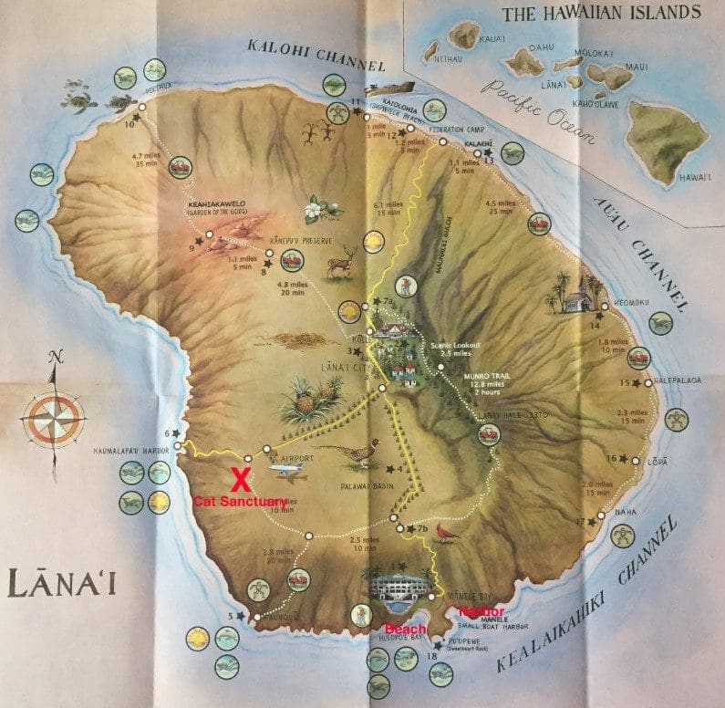
Map of Lāna‘i showing Harbor, Beach and Cat Sanctuary marked in Red and paved roads highlighted in Yellow.
The map shows Points of Interest and the Harbor, Hulopo‘e Beach and the Cat Sanctuary are marked in red. The Beach is 4/10ths of a mile from the Harbor while Lāna‘i City is 7 miles and 1,500′ above the Harbor. The Cat Sanctuary is a little over 12 miles from the harbor and is located near the airport (LNY).
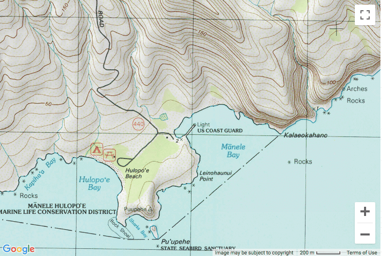
Curious about the topography? Check out this topographic map of the area around the Harbor courtesy of https://www.topozone.com/hawaii/maui-hi/harbor/manele-small-boat-harbor/.
More Reading:
Read Part 2 – Transportation … How do I get there and get around?